Tuesday, June 28, 2011

A Rest Day in the Bridger Valley

Greetings,

June 27, 2011 – A rest day in the Bridger Valley – We took the day off and explored the Bridger Valley, did laundry, and relaxed.  We took the horses to the rodeo grounds in Lyman so they could walk around in the calf-roping pens while we did our laundry.  While there, we met two local rodeo cowboys and some of the next generation of Bridger Valley rodeo cowboys.  My endurance riding connections across the west continue to amaze me because Clint Hallum, one of the local cowboys, raced dogs with Doug Swingley and appeared by the brand to have a Jeff Stuart horse.  Meanwhile in camp, the cows and badgers conducted their daily activities.  On Wednesday, we will begin our ride across the salt flats of Utah's west desert.

Best Regards,
Tom N

Sunday, June 26, 2011

On The Pony Express Trail - June 25 2011


Greetings,

Once again, my update is delayed due to intermittent cell phone service.

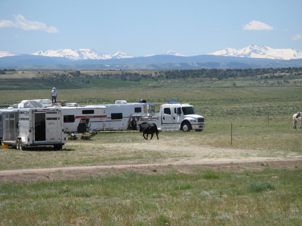
June 25, 2011 – Farson to Granger Wyoming – Today we rode along the Big Sandy River out of Farson to Lombard Crossing on the Green River and then on to Granger Wyoming.  Along the Big Sandy we traveled through several sections with deep ruts from the pioneer wagons.  Many times the trail appears to be another two-track road through the sagebrush but at other times you can look and see just how deep the pioneer wagons dug into the earth.  Along the Big Sandy we stopped to water the horses at two very obvious meadows along the river.  If the meadows were there 150 years ago, then the meadows were undoubtedly pioneer camps along the trail.  We also rode past the place where a US Army wagon train was burned by the Mormons during the Mormon conflicts in 1857.  The conflicts were eventually resolved by Brigham Young years later leading to Utah statehood.  We were told that burning the US Army wagon train led to the demise of the firm Russell, Waddell, and Majors, the firm that bankrolled and operated the Pony Express.

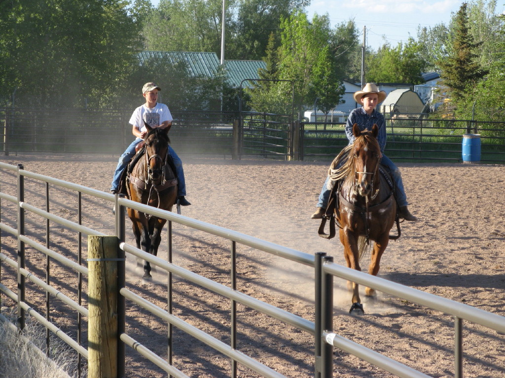
Last night while out walking, I saw two men leading pack horses heading into camp.  It turns out that the two men were on a multi-week mountain man trek across the same trails.  The two modern-day mountain men left Independence Rock a few days ahead of us and are heading to a rendezvous in NE Utah.  The two men, Scott "Doc" Olson, and Oliver McCloskey, ride about 30 miles per day, feed their horses on trail grasses, and travel across the country much the same as men did in the 1830s and 1840s.  There we still some mountain men in the 1860s during the Pony Express operation and seeing them, like seeing the Mormon handcart companies, added an element of reality to our travels across the Pony Express trail.

The two took the time to show Cindy and I their pack contents and their tack.  We were impressed with the pack saddle tree made partially from elk horns, their buffalo skins, their Navajo saddle blankets, their period clothing, and their way of travel.  Everything was authentic, circa 1835.  Their travel was another confirmation to me that thirty miles per day is a good pace that a horse can keep up indefinitely.  Meeting the two mountain men was an unexpected surprise just as it was a surprise to meet one friend of theirs a year ago when I was on horseback on the Strawberry Fields ride in the Uinta Mountains in NE Utah.

Early this morning the men watched our group head out on the trail and asked, "Why are they doing this ride?"  Cindy explained that some, if not most, seem to be riding the 2011 XP for American Endurance Riding Conference points and standings and that we have different motivations.  She mentioned that we have taken the time to ride our horses to the bank of the Missouri River, we hope to go on and finish the trail in California, that we rode to the Narrows outside of Oak Nebraska, we hiked to the top of Register Rock, and that we have taken many other opportunities to experience the history along the trail.  One mountain man nodded with understanding and remarked, "Tom is a man of good medicine" which I take as a high complement.

Best Regards,
Tom N

Friday, June 24, 2011

On the Pony Express trail -- June 24 2011


Greetings,

June 24, 2011 – South Pass City to Farson, Wyoming – Today, like yesterday, we awoke to early morning thunder and rain.  We cannot wait for the weather so we set out to follow the pioneer tracks and cross the Continental Divide at South Pass.  After about two hours on the trail, we made our last crossing on the Atlantic side over Sweetwater River.  The river is high and the sloughs are boggy so we made a quick decision to detour cross the river on a highway bridge.

After the bridge, we headed back east to the pioneer trails and over South Pass.  South Pass is rolling sage prairie—true high desert at around 7,000 feet.  Then, after a few miles of trail and a few rolling hills, we were at Pacific Springs and on the Western Slope.  There is an abandoned ranch at Pacific Springs as well as a Pony Express station.  Remnants of the ranch survive, but the Pony Express station is long gone and not even a memory anymore.  We continued westward on nice two-track trails under darkening skies and before our lunch stop at 25 miles, and the rain and hail let loose.  The lightning was loud and close and I suggested that we spread out so a lightning strike would not kill us all.  My suggestion was met with silence except for the punctuation of thunder.  All of us came safely into lunch just as the storm was ending.

I rode Whiskey today and he is doing well on the trails.  Both Frank and Whiskey continue to be sound and eager to head down the trail.  Whiskey has short periods of lingering lameness from his chronic laminitis and the lameness lasts for a few steps when he steps wrong, but in general, Whiskey continues to move well down the trail.  Whiskey has gained considerable confidence and sometimes leads the group down the trail at a nine or ten MPH trot and for a few moments, I have the feelings of the Pony Express riders on a mustang horse.  We are in mustang country although we have not seen any wild horses.  We have seen antelope, deer, and one group saw a moose yesterday.

One thing that has impressed me is using a GPS track for the trail.  There are no day-glow ribbons spoiling the high desert.  On the actual pioneer trails, there is usually a two-track trail and concrete posts marking the trail every mile or so.  The lack of trail modern markings makes the 2011 XP ride feel much more of an adventure and less like a packaged experience.  Many of us have talked about the feeling and we may find it difficult to go back to the highly structured world of most endurance rides.  On the XP, we are really expected to care for our horses.  We decide which horse to start and how far to ride.  We decide about how much time to spend at the lunch hold and we decide when to stop on the trail for grass and water.  Each morning, Dave Nicholson is usually a mile or so down the trail to check the soundness of the horses, but we are largely on our own and the horses are doing very well.  Relying on GPS tracks has given some riders difficulty, but all the riders seem to make it to lunch and then on to the finish, so the difficulties may be more psychological discomfort rather than real distress.  To me, the 2011 XP is true endurance riding.

Best Regards,
Tom N


On the Pony Express trail, June 22 2011


Greetings,

The cellphone coverage has been very limited so I will catch up with a few posts.

June 22, 2011 – Murphy Ranch, Independence Rock, to Sweetwater Junction (Sixth Crossing) – Last night was the Summer Solstice and Cindy and I camped alone in the desert near Independence Rock.  The ride was broken into two segments; a thirty-six mile segment and a fourteen mile segment.  I decided to start my ride at Handcart Ranch to shorten the first half to about 25 miles and I rode Whiskey.

Shortening the ride gave us time to explore Independence Rock.  Independence Rock is a large granite monolith rising out of the Sweetwater River valley floor and the rock was a major landmark on the pioneer trials.  The pioneers tried to make Independence Rock by the fourth of July.  Like register cliffs, the rock is inscribed with many names of the early settlers.  We climbed to the top of the rock and read some of the many inscriptions.  The rock surface also shows signs of glacial polish from the Paleocene ice flows.  We could observe the riders coming from the top of Independence Rock.

After the rock, we rode through Handcart Ranch which is property purchased by the LDS church where the church teaches the history of the Mormon migration and many re-enact the handcart migrations of their ancestors.  We saw Handcart Companies in the area around Martin's Cove on the ranch.  While at the ranch, I was riding with Max Merlich on his mule Guadalupe.  Many of the visitors to the ranch site were very interested in our journey.  Some were particularly interested in the mule and wanted pictures.  In fact, one group asked that Whiskey move so that there would not be a horse in the photo.  Whiskey, an American Mustang was slightly offended, but he respected the wishes of the visitors and preserved the dignity of the situation.

While passing one of the handcart companies, I took the opportunity to ride away from our group and stop to listen to the sounds of the pioneer re-enactment.  Whiskey and I stood on the high desert and listened as the handcart company slowly made its way on the trail.  There were two and three people at the bar pulling each cart, others walked along side in the procession, and the participants were dressed in period clothes.  They were LDS people reliving the lives of their ancestors.  I could hear the wheels of the handcarts and hear the chatter of the people.  As I sat on my horse and looked across the desert at the handcart companies, at the sage-covered hills, at Split Rock, and listened to the sounds of the pioneers, it was easy for my mind to drift back in time to the Overland Trail and the Pony Express 150 years ago.

Later on, we continued our ride on two-track primitive roads that are the actual pioneer trails.  Like the handcart re-enactors, we followed in the footsteps of the Pony Express and the early settlers.  I found part of a worn ox-shoe on a section of the trail rutted by the pioneer wagons.  I wondered if the shoe was original or left from a more recent re-enactment and I asked my companions.  I was assured that the piece was well over a 100 years old and original.

While on Independence Rock today, Cindy and I talked about the trip and our speed.  I am riding half-days which preserves my horses as well as gives us the opportunity to visit some of the historical sites along the trail.  We decided that fifty miles per day may be too fast to explore the pioneer trails– after over a month on the trail, we have concluded that our pace is too fast which is a sure sign that we have stepped out of modern life, even if for only a short period of time.  We are very lucky.

Best Regards,
Tom N


On the Pony Express Trail - June 23 2011


Greetings,

June 23, 2011 – Sixth Crossing to South Pass City – Today and Tomorrow are the Continental Divide sections of the Pony Express, Oregon, California, and Mormon Trails.  We rode from the sixth crossing of the Sweetwater River to South Pass City.  South Pass City is slightly north of the actual trail but land ownership issues have led to the slight deviation from the actual trails.  We passed Rocky Ridge and the site of the Rocky Ridge Pony Express Station.  We traveled through McLean Meadows which are described in Richard Burton's book.  Portions of McLean Meadows were very boggy and Frank lost his right front shoe.  Dave Rabe gave an Easy Boot to me and I used that for the rest of today's trail and Chris Herron nailed my spare shoe on Frank after the ride.

There was no easy way to get to lunch and I decided to ride Frank fifty miles.  Even though access to lunch was difficult, some of the largest rigs made the trek.  In the process, the large rigs churned up a bog and one rig became stuck.  The stuck rig was not driver error, but a problem resulting from the very large rigs that preceded it through the mud.  We were met up the trail by Tracy Blue who wisely went to South Pass City first, unhooked her trailer, and then drove to meet us with lunch in her truck avoiding the problems of towing a trailer on uncertain roads.

Today's trail segment holds special significance for the Mormon pioneers.  We left from Martin's Cove and passed by Rock Creek Hollow.  Both sites are places where Mormon handcart companies became stranded in November snows and many members of the company died of exposure, exhaustion, and starvation.  Today, the LDS church has worked with the BLM to recognize the historical significance of the sites.  In preserving the Mormon heritage, the LDS church has also preserved the Pony Express, Oregon, and California trails.  Last night, we heard the handcart story from Elder Bagley whose ancestors participated in the handcart company rescue.  Elder Bagley is serving an adult mission at the Martin's Cove historical site and he and his wife painted a vivid picture of the handcart trouble and eventual rescue.

Our day ended just above South Pass City which is a historic mining town preserved by the State of Wyoming.  South Pass City was active in the late 1860s and today the remaining structures are preserved as a large museum representing Wyoming's mining heritage.

Tomorrow, we will rejoin the Pony Express and other trails at the summit of South Pass on the Continental Divide.

Best Regards,

Tom N


On the Pony Express Trail - June 19 2011


Greetings,

June 19, 2011 – Stinking Creek to Murphy Ranch – Today we crossed the North Platte River and rejoined the Pony Express Trail southwest of Casper Wyoming just west of emigrant gap.  We rode across the Bates Creek Stock Driveway.  In Wyoming, there are various stock driveways that are still used to move animals from winter pastures to summer pastures.  On the Big Horn 100, there are two – the Dugway and one that I cannot remember the name of that goes from Trapper Creek on the valley floor to Jack's Creek  on the Big Horn plateau.  Today we rode down the Bates Creek stock driveway that goes from the Shirley Basin to the North Platte River.

We crossed the North Platte on an old highway bridge that is now used for pedestrian travel.  The North Platte is flooding and the river is very swift.  The bridge pylons made substantial wakes in the water and I would not want to swim across the North Platte under these conditions.  However, one rider's horse got away and swam the river twice.  The story is that the horse crossed the river once and then ran scared and ran hard.  The horse was spooked by something real or imagined and was running wild.  The horse then became cornered by a fence line and jumped into the river at a full gallop with a magnificent splash, swam back across, and disappeared into the sage-covered hills.  After an hour or so of searching, the horse was found and reunited with its owner.

We rejoined the trail just west of Emigrant Gap and our lunch stop was near the Devil's Backbone on the Oregon Trail.  We should be able to follow the Pony Express Trail the rest of the way to Virginia City except for a short section in Eastern Utah through Salt Lake City where there is too much development to ride safely.  Our detour through the Shirley Basin was a very nice diversion but now we are back on the historic trails.

We are taking a two-day break to resupply.  The main camp is in Alcova Wyoming but some of us have moved to the Natrona County Fairgrounds in Casper.  Frank and Whiskey are in a large field and roaming freely for the first time in several weeks.  We plan to purchase hay and do laundry in Casper.  We shopped for groceries today at a Smiths and it was nice to visit a real food store with an acceptable produce selection.  We plan to rejoin the main group on Tuesday and head back out on the trail on Wednesday.  The next five days of riding will take us across Wyoming to Fort Bridger.

Best Regards,
Tom N

On The Pony Express Trail - June 18 2011


Greetings,

June 18, 2011 – Across the Shirley Basin in Wyoming – I started early this morning with only a few other riders.  There was ice on the water buckets and it was good that we blanketed the horses last night.  We left the ranch and headed west across the Shirley Basin.  In 25 miles of trail, we passed one ranch house and today we are camped on Stinking Creek – a tributary to the North Platte.  An eastern name for Stinking Creek would be Stink Brook.  Esterbrook, where we camped a few days ago, was named after a lady with the first name of Ester so Stink Brook would be a fine name for a small waterway.  And tomorrow, we will rejoin the Pony Express trail near the North Platte River.

The Shirley Basin is a remote area north of Laramie.  I have met descendents of the Shirley Basin ranching families and I have looked across the Shirley Basin from Interstate 80, but I have never explored the area.  Today, I rode across the north perimeter of the basin and the country is very remote.  The wind was blowing and it was cool, but the scenery was true west – red soil, sagebrush and antelope, a few cows, and the endless sky.  I thought back to Kansas and Nebraska and it seems like we have come a long way in four weeks.  At any moment on the trail, our pace seems slow, but as the miles are added  together, we have traveled from the Missouri River to central Wyoming.  I like traveling at 50 miles per day.  When Cindy and I step off the trail to buy groceries or gas, 2011 America seems foreign.  We have our own community and we are working together to get the horses across the Western US.  Right now, our lives are simple and the complications of modern America seem unnecessary.  Cindy and I have become accustomed to living on the trail.

The other thing that has impressed me is how difficult it would be to fully support someone who was riding fifty miles per day, every day.  We are four weeks on the trail and some crews are falling apart.  The details are sketchy, but it appears as if working together and living together under stressful conditions is too much for some personality combinations.  I generally ride half days and Cindy and I use the second half of the day to resupply and meet the needs of the horses.  As far as I know, there is only one person who has completed 50 miles every day and her crew is totally committed to her travel.  The rest of us find ways to work with our crews to lessen the responsibilities.

Best Regards,
Tom N


On The Pony Express Trail -- June 17 2011


Greetings,

June 17, 2011 – Esterbrook to Marshall Wyoming – Our trip today took us through the high alpine country north and west of Laramie Peak.  Last night it stormed and the day dawned clear and cold.  It was 44 degrees in the van this morning.  Cindy and I took both Frank and Whiskey out and we both rode the first 28 miles of the ride today.  We climbed from Esterbrook to 8,000 feet on the trail and it was windy and cold the whole way.  A few days ago we were warm but today it was windy and quite cold.  As usual, I have all of the clothes necessary to make the conditions pleasant, but those closes were in the van.  I was wearing a polo shirt, turtleneck, and a wind shirt.  Adding a fleece vest would have been nice.  Even so, the alpine meadows were spectacular.  As we came around to the west of Laramie Peak, we could see the Medicine Bow Mountains south of Interstate 80 and the Never Summer Range in Colorado.  The Never Summer mountains are still covered with snow.  We descended to the Shirley Basin and we are camped at a ranch in Marshall Wyoming.

The owner of the ranch is in his early 70s and is a true Wyoming rancher.  His family homesteaded the area over 100 years ago, but the ranch house was at a slightly different spot and the ranch is technically not a Wyoming Centennial Ranch.  In the 1950s, there were sixteen families and a school in Marshall, now there are two families.  He and his father drove school buses and used horse-drawn sleighs to fetch the school children in the winter.  He talked further about the winter conditions and he mentioned that he got his truck stuck in a drift on January 20th this winter.  He did not free the truck until April and used a snowmobile to get to the ranch house.


Tomorrow we will cross the Shirley Basin.

Best Regards,
Tom N


Saturday, June 18, 2011

Pony Express -- July 16 2011


Greetings,

June 16, 2011 – Guernsey to Esterbrook Wyoming – Wyoming high plains leading to the mountains – Esterbrook is a mountain townsite just west of Laramie Peak in central Wyoming.  We are camped south of the townsite at about 7,000 feet.  Four weeks ago we were in Beatrice Nebraska at well under 1,000 feet.  Laramie Mountain is another landmark on the Oregon Trail and the mountain has been in our view since east of Torrington.  The top of Laramie Peak is over 10,000 feet.  Today at lunch we were east of Laramie Mountain, our camp is north or the peak, and tomorrow we will ride far to the west of Laramie Mountain.

We followed the Pony Express trail for about three-quarters of the ride today.  The Pony trail then heads north to Casper and we are going south to avoid the traffic and the pavement.  Going south also allows us to enjoy some mountain riding on our way to the Shirley Basin in Wyoming.

For those who regularly drive Interstate 25, we crossed under the road at Wyoming milepost 104.

Best Regards,
Tom N